Forest Land Change Assessment of Karang Mumus Sub-Watershed Area
Abstract
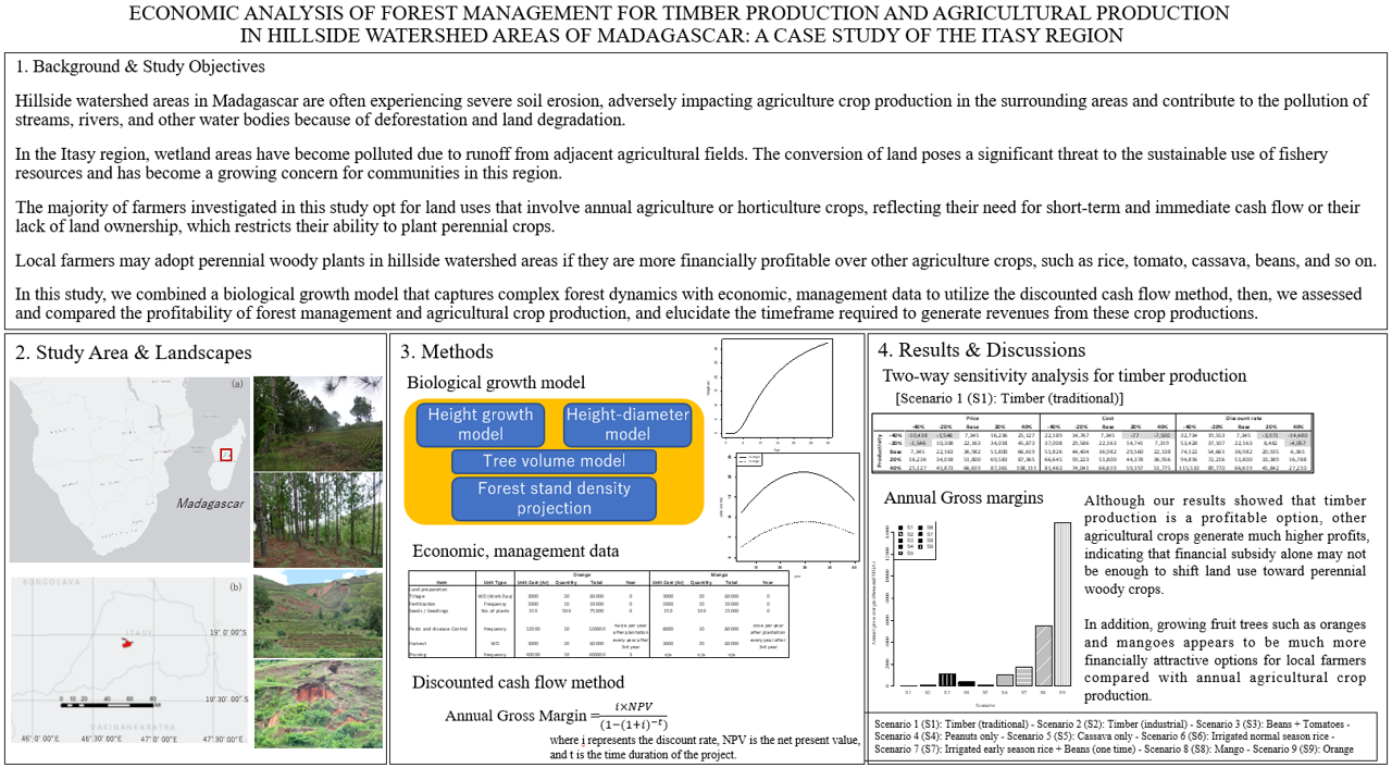
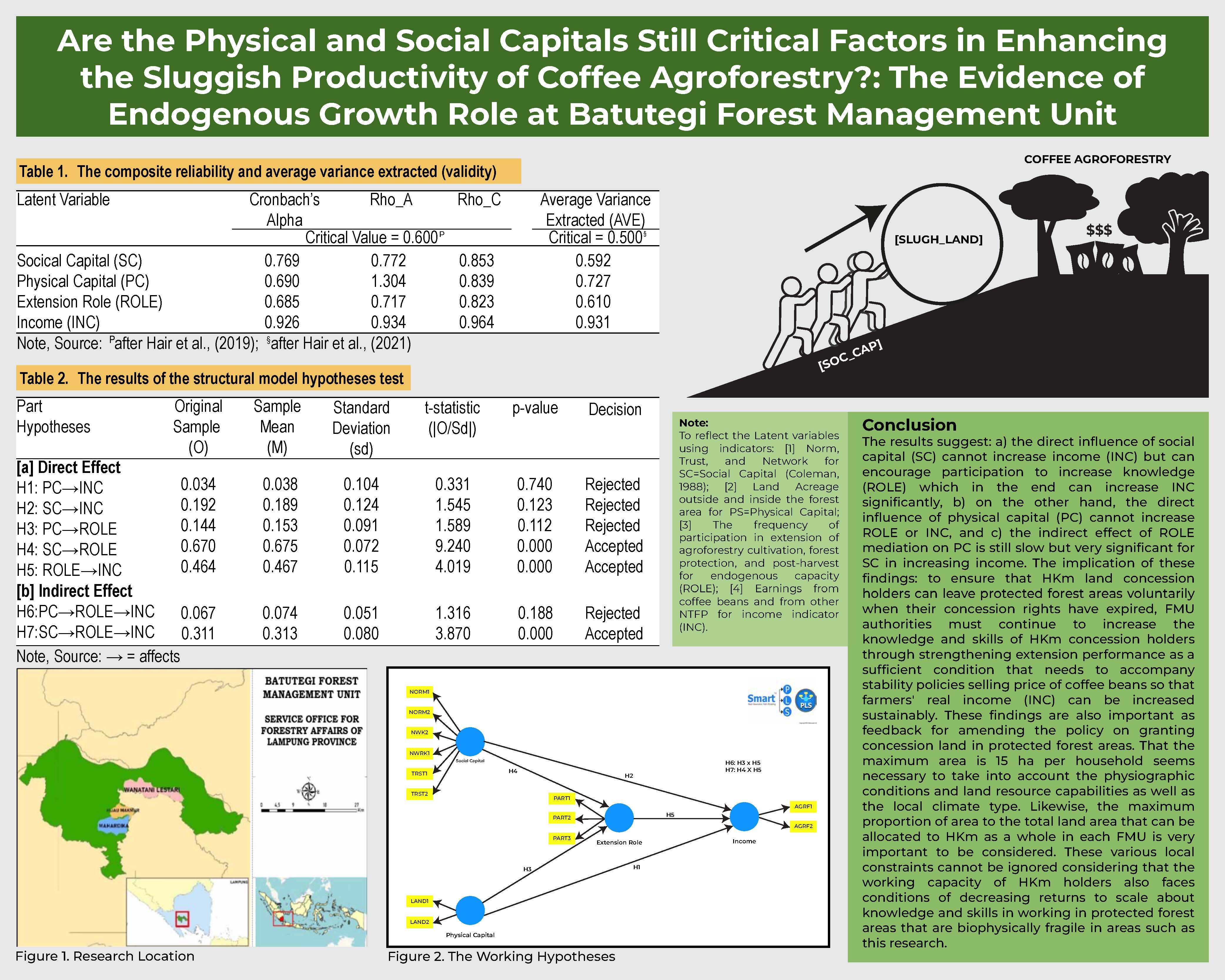
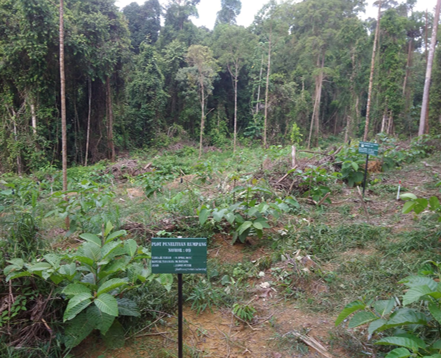
Karang Mumus watershed is an important area as a port and gateway to the inland of East Kalimantan, causing the trade sector and water transportation services in this city to be very developed. Traders and immigrants from various regions who came in, stopped by, performed business, and stayed have caused the riverbanks to develop into economic and trade centers. One of the issues in the Karang Mumus sub-watershed is the conversion of forest area to agricultural land. With the improper use of agrotechnology and soil conservation, agricultural operations result in erosion and reduced land yield. This study aims to evaluate the Karang Mumus sub-potential watersheds to support land capability by using the overlay method (geoprocessing) of a geographic information system (GIS) based on criteria for classifying land capabilities and a data analysis approach. The findings revealed that the Karang Mumus sub-land watersheds primarily are categorized as land capacity class III, with a moderate erosion limiting factor that covers 15,864 ha (50.45%). The remaining areas are categorized into land capability classes IV and VI, with class IV having a severe slope limiting factor and class VI having a severe slope limiting factor with a fairly strong soil sensitivity to erosion, covering 8,751.14 ha (27.83%) and 6,829.85 ha (21.72%), respectively. Class III land is recommended for agricultural cultivation, application of appropriate agro-technology, and soil and water conservation. This study recommends that class IV and VI lands area are used for community forests or plantation forests managed by government agencies involved in the forest area stabilization center (BPKH) Region IV Samarinda.
References
Agus, C., & Wulandari, D. (2012). The abundance of pioneer vegetation and their interaction with endomycorrhiza at different land qualities after Merapi eruption. Jurnal Manajemen Hutan Tropika, 18(3), 145–154. https://doi.org/10.7226/jtfm.18.3.145
Arsyad. (2010). Konservasi tanah dan air (2nd. ed.). Bogor: IPB Press.
[BPDAS] Balai Pengelolaan Daerah Aliran Sungai Mahakam Berau (2017). Laporan hasil identifikasi kerusakan Sub DAS Karang Mumus Tahun 2017. Kota Samarinda: BPDAS.
[BPS] Badan Pusat Statistik Kota Samarinda (2017). Kota Samarinda dalam angka Tahun 2017. Samarinda: BPS.
Chen, M., Zeng, L., Huang, Z., Lei, L., Shen, Y., & Xiao, W. (2021). Evaluating suitability of land for forest landscape restoration: A case study of three Gorges Reservoir, China. Ecological Indicators, 127, 107765. https://doi.org/10.1016/j.ecolind.2021.107765
Endayani, S., Sadono, R., Kusumandari, A., & Hartono (2019). Social and economic vulnerability in the Sub-Watershed of Karang Mumus, East Kalimantan Province. Jurnal Manajemen Hutan Tropika, 25(2), 93–103. https://doi.org/10.7226/jtfm.25.2.93.
George, N., Rao, R., Killur, B., & Cornelio, D. L. (2013). Land use conversion and soil properties in a lowland tropical landscape of Papua New Guinea. Jurnal Manajemen Hutan Tropika, 19(1), 39–45. https://doi.org/10.7226/jtfm.19.1.39
Hadi, A. N., & Shrestha, D. (2011). Analyzing runoff dynamics through parameterizing a hydrological model in a watershed: A case study in upper Serayu Basin, Central Java Province, Indonesia. Indonesian Journal of Geography, 42(1), 1–24.
Halim, F. (2014). Pengaruh hubungan tata guna lahan dengan debit banjir pada Daerah Aliran Sungai Malalayang. Jurnal Ilmiah Media Engineering, 4(1), 45–54.
Harini, R., Susilo, B., & Nurjani, E. (2016). Geographic information system-based spatial analysis of agricultural land suitability in Yogyakarta, Indonesia. Indonesian Journal of Geography, 47(2), 171–179. https://doi.org/10.22146/ijg.9260
Kurowska, K., Kryszk, H., Marks-bielska, R., & Mika, M. (2020). Conversion of agricultural and forest land to other purposes in the context of land protection: Evidence from Polish experience. Land Use Policy, 95, 104614. https://doi.org/10.1016/j.landusepol.2020.104614
Maryati, S. (2012). Land capability evaluation of reclamation area in Indonesia coal mining using LCLP software. Procedia Earth and Planetary Science, 6, 465–473.
Matos, M. De, Carolina, A., Fernandes, C., Souza, R., Alves, C., Araujo, D., ..., & Carneiro, H. (2021). Effects of native forest and human-modified land covers on the accumulation of toxic metals and metalloids in the tropical bee Tetragonisca angustula. Ecotoxicology and Environmental Safety, 215, 112147. https://doi.org/10.1016/j.ecoenv.2021.112147
Mora, F., Arreola-villa, F., Arroyo-, V., Nathalia, P., Balvanera, P., Flores-casas, R., ..., & Ortega-huerta, M. A. (2021). Effects of landscape composition and site land-use intensity on secondary succession in a tropical dry forest. Forest Ecology and Management, 482, 118818. https://doi.org/10.1016/j.foreco.2020.118818
Nezami, M. T. (2013). Effect of land use types and slope on soil erodibility factor in Alborz Province, Iran. International Research Journal of Applied and Basic Sciences, 4(1), 25–30.
Nugraha, S., & Damen, M. (2013). Utilization of geotagged photograph, remote sensing, and GIS for post-disaster damage. Indonesian Journal of Geography, 45(2), 187–204.
Oduro, J., & Agyemang-duah, W. (2020). Identifying spatially-explicit land use factors associated with forest patch sizes in a forest reserve in Ghana. Land Use Policy, 101, 105135. https://doi.org/10.1016/j.landusepol.2020.105135
Olsen, S. L., Haug, S., & Rusch, G. (2021). Recent forest on abandoned agricultural land in the boreonemoral zone – Biodiversity of plants and fungi in relation to historical and present tree cover. Forest Ecology and Management, 489, 119045. https://doi.org/10.1016/j.foreco.2021.119045
Oluwasegun, A. H. (2017). GIS analysis of flood vulnerable area in Benin–Owena River Basin Nigeria. Indonesian Journal of Geography, 49(1), 27–33. https://doi.org/10.22146/ijg.12777
Piccinelli, S., Brusa, G., & Cannone, N. (2020). Climate warming accelerates forest encroachment triggered by land use change: A case study in the Italian Prealps (Triangolo Lariano, Italy). Catena, 195, 104870. https://doi.org/10.1016/j.catena.2020.104870
Pertiwi, N., Sapei, A., Januar, M. J. P., & Astika, I. W. (2011). Pembangunan konsep ekohidrolik sebagai upaya pengendalian bencana wilayah pemukiman pada Sungai Lawo Kabupaten Soppeng. Jurnal Forum Bangunan, 9(1), 26–33.
Ping, L. Y., Sung, C. T. B., Joo, G. K., & Moradi, A. (2012). Effects of four soil conservation methods on soil aggregate stability. Malaysian Journal of Soil Science, 16, 4356.
Pratiwi, & Narendra, B. H. (2012). Pengaruh penerapan teknik konservasi tanah terhadap pertumbuhan pertanaman mahoni (Swietenia macrophylla King) di Hutan Penelitian Carita, Jawa Barat. Jurnal Penelitian Hutan dan Konservasi Alam, 9(2), 139150.
Purwandari, T., Hadi, M. P., & Kingma, N. C. (2011). A GIS modelling approach for flood hazard assessment in part of Surakarta City, Indonesia. Indonesian Journal of Geography, 43(1), 63–80.
Rasyid, A. R., Bhandary, N. P., & Yatabe, R. (2018). Implementing landslide susceptibility map at watershed scale of Lompobattang Mountain South Sulawesi, Indonesia. Indonesian Journal of Geography, 50(2), 197–204. https://doi.org/10.22146/ijg.16632
Rawat, K. S., Jacintha, T. G. A., & Singh, S. K. (2018). Hydro-chemical survey and quantifying spatial variations in groundwater quality in coastal region of Chennai, Tamilnadu, India–A case study. Indonesian Journal of Geography, 50(1), 57–69. https://doi.org/10.22146/ijg.27443
Saida, Jusoff, K., Islan, M., Haris, A., & Nraeni (2013). Evaluation of land capability for agriculture in the upstream of Jeneberang Watershed, South Sulawesi. American-Eurasian Journal of Agricultural & Environmental Sciences, 13(8), 1027–1033.
See, K. L., Nayan, N., Saleh, Y., Hashim, M., Mahat, H., & Rahaman, A. (2018). Well water site selection for flood victim in Malaysia. Indonesian Journal of Geography, 50(2), 205–210. https://doi.org/10.22146/ijg.32925
Talukdar, S., Uddin, K., Akhter, S., Ziaul, S., Reza, A., Islam, T., & Mallick, J. (2021). Modeling fragmentation probability of land-use and land-cover using the bagging, random forest and random subspace in the Teesta River. Ecological Indicators, 126, 107612. https://doi.org/10.1016/j.ecolind.2021.107612
Wasis, B. (2012). Soil properties in natural forest destruction and conversion to agricultural land, in Gunung Leuser National Park, North Sumatera Province. Jurnal Manajemen Hutan Tropika, 18(3), 206–212. https://doi.org/10.7226/jtfm.18.3.206
Wegscheider, S., Purwanto, J., Margono, B. A., Nugroho, S., Budiharto, Buchholz, G., & Sugardiman, R. A. (2018). Current achievements to reduce deforestation in Kalimantan. Indonesian Journal of Geography, 50(2), 109–120. https://doi.org/10.22146/ijg.23680
Weng, L., Qian, M., Xia, M., Xu, Y., & Li, C. (2020). Land use/land cover recognition in arid zone using a multi-dimensional multi-grained residual forest. Computers and Geosciences, 144, 104557. https://doi.org/10.1016/j.cageo.2020.104557
Authors

This work is licensed under a Creative Commons Attribution 4.0 International License.
Jurnal Manajemen Hutan Tropika is an open access journal which means that all contents is freely available without charge to the user or his/her institution. Users are allowed to read, download, copy, distribute, print, search, or link to the full texts of the articles in this journal without asking prior permission from the publisher or the author. This is in accordance with the Budapest Open Access Initiative (BOAI) definition of open access.


