The Possibility of COVID-19 Pandemic in Eliminating Burning Activities: A Case Study at Ogan Komering Ilir Regency, South Sumatera
Abstract
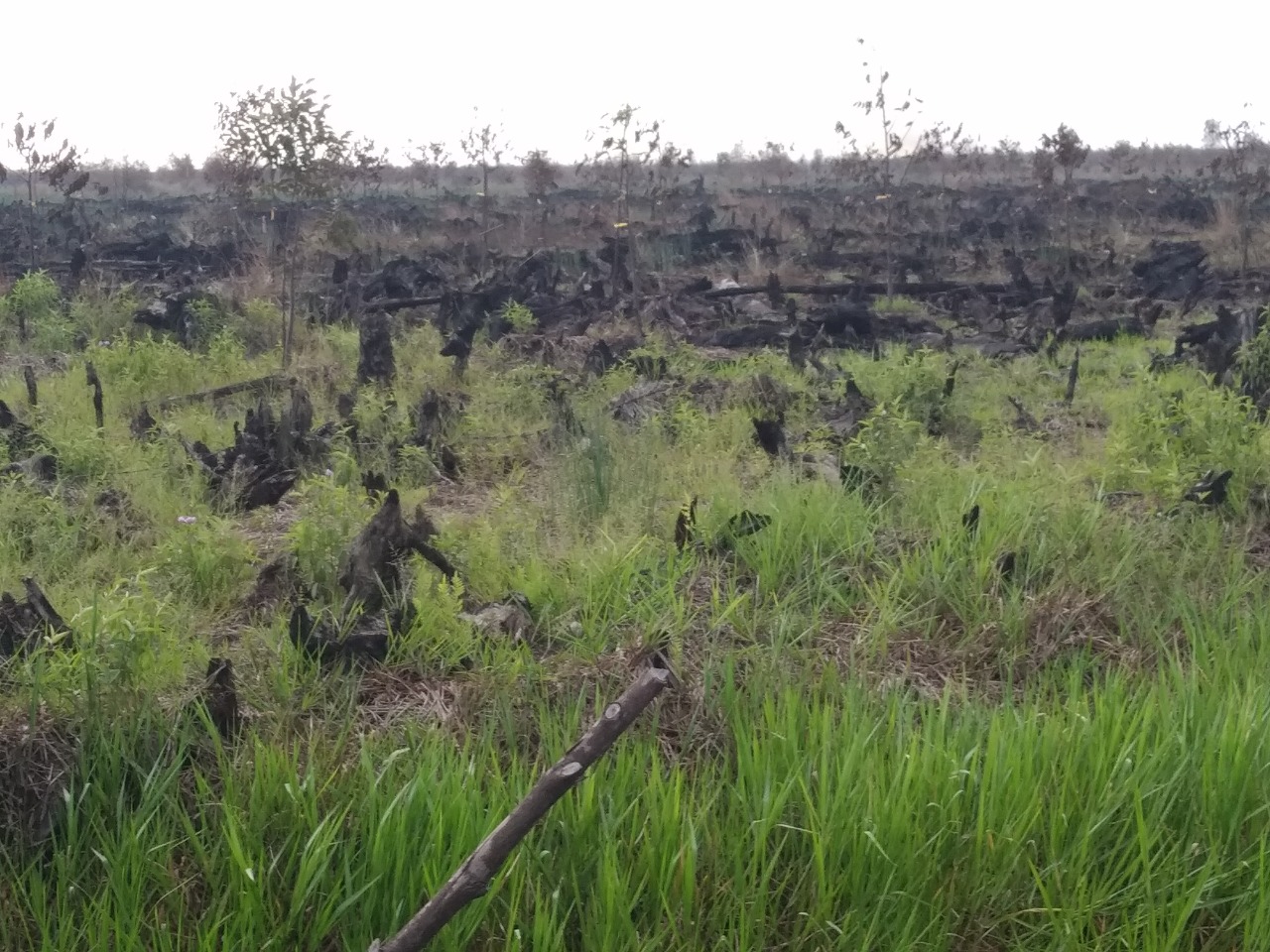
Forest and land fires occur almost every year in South Sumatera Province, including at Ogan Komering Ilir (OKI) Regency, mainly due to uncontrolled burning activities. This region has the largest peatland responsible for the adverse haze impacts. The advent of the coronavirus (COVID-19) pandemic in early 2020 has triggered massive consequences across the global communities, including Indonesia. Therefore, large-scale regulations on social restrictions were enacted. The purpose of this study is to analyze the variations in hotspots as forest and land fire indicators before and during the COVID-19 pandemic in OKI as well as to determine the rainfall effects. Daily Terra/Aqua MODIS satellite feeds and rainfall data between January 2018 and December 2020 served as the research materials. Subsequently, the paired t-test and correlation assessment were used to examine the hotspot variations in both datasets, respectively. The results showed significant statistical differences before and during the pandemic. Consequently, social restrictions were assumed to instigate the decline in burning activities. Furthermore, the rainfall demonstrated a vulnerable correlation to the hotspots, indicating that human factor was more pronounced as a fire trigger.
References
Afifuddin, Purwandani, A., Ardiyanto, R., Sumargana, L., & Frederik, M. C. G. (2019). Is land and forest fire in Ogan Komering Ilir, Southern Sumatera, affected by climate change?. IEEE Asia-Pacific Conference on Geoscience, Electronics and Remote Sensing Technology (AGERS), 2019, 9598, https://doi.org/10.1109/AGERS48446.2019.9034289
Aldrian, E., & Susanto, R. D. (2003). Identification of three dominant rainfall region within Indonesia and their relationship to sea surface temperarure. International Journal of Climatology, 23, 1435–1452. https://doi.org/10.1002/joc.950
Ardiansyah, M., Boer, R., & Situmorang, A. P. (2017). Typology of land and forest fire in South Sumatera, Indonesia based on assessment of MODIS data. IOP Conference Series: Earth and Environmental Science, 54(1), 012058. https://doi.org/10.1088/1755-1315/54/1/012058
Armanto, M. E., Damiri, N., & Putranto, D. D. A. (2018). Performance of fire risk estimates based on soil moisture of selected peat land use. E3S Web of Conferences, 68, 04018. https://doi.org/10.1051/e3aconf/20186804018
Asteriniah, F., & Sutina. (2017). Implementasi kebijakan pengendalian kebakaran hutan dan lahan gambut di Ogan Komering Ilir. Jurnal Abdimas Mandiri, 1(2), 7177. https://doi.org/10.36982/jam.vIi2.338
[BBSDLP] Balai Besar Sumber Daya Lahan Pertanian. (2011). Peta lahan gambut Indonesia skala 1:250.000. Bogor: Badan Penelitian dan Pengembangan Pertanian.
Dennis, R. A., Mayer, J., Applegate, G., Chokkalingam, U., Colfer, C. J. P., Kurniawan, I., …, & Stolle, F. (2005). Fire, people and pixels: Linking social science and remote sensing to understand underlying causes and impacts of fires in Indonesia. Human Ecology, 33(4), 465504. https://doi.org/10.1007/s10745-005-5156-z
Fujii, Y., Iriana, W., Oda, M., Puriwigati, A., Tohno, S., Lestari, P., …, & Huboyo, H. S. (2014). Characteristics of carbonaceous aerosols emitted from peatland fire in Riau, Sumatera, Indonesia. Atmospheric Environment, 87, 164169. https://doi.org/10.1016/j.atmosenv.2014.01.037
Hendrawan, I. G., Asai, K., Triwahyuni, A., & Lestari, D. V. (2019). The interanual rainfall variability in Indonesia corresponding to El Niño Southern Oscillation and Indian Ocean Dipole. Acta Oceanologica Sinica, 38, 57–66. https://doi.org/10.1007/s13131-019-1457-1
Heriyanto, E., Syaufina, L., & Sobri, M. (2015). Forecasting simulation of smoke dispersion from forest and land fires in Indonesia. Procedia Environmental Sciences, 24, 111119. https://doi.org/10.1016/j.proenv.2015.03.015
Indratmoko, S., & Rizqihandari, N. (2019). Burn area detection using Landsat 8 OLI TIRS. IOP Conference Series: Earth and Environmental Science, 338, 012035. https://doi.org/10.1088/1755-1315/338/1/012035
.
Jayarathne, T., Stockwell, C. E., Gilbert, A. A., Daugherty, K., Cochrane, M. A., Ryan, K. C., …, & Yokelson, R. J. (2018). Chemical characterization of fine particulate matter emitted by peat fires in Central Kalimantan, Indonesia, during the 2015 El Niño. Atmospheric Chemistry and Physics, 18(4), 25852600. https://doi.org/10.5194/acp-18-2585-2018
Kiely, L., Spracklen, D. V., Wiedinmyer, C., Conibear, L., Reddington, C. L., Archer-Nicholls, S., …, & Latif, M. T. (2019). New estimate of particulate emissions from Indonesian peat fires in 2015. Atmospheric Chemistry and Physics, 19(17), 1110511121. https://doi.org/10.5194/acp-19-11105-2019
Kiely, L., Spracklen, D. V., Wiedinmyer, C., Conibear, L., Reddington, C. L., Arnold, S. R., …, & Adrianto, H. A. (2020). Air quality and health impacts of vegetation and peat fires in Equatorial Asia during 2004–2015. Environmental Research Letters, 15(9), 094054. https://doi.org/10.1088/1748-9326/ab9a6c
Kirana, A. P., Sitanggang, I. S., & Syaufina, L. (2015). Poisson clustering process on hotspot in peatland area in Sumatera. Telkomnika, 13(4), 1376. https://doi.org/10.12928/TELKOMNIKA.v13i4.2272
Meiriza, A., Malik, R. F., & Nurmaini, S. (2017). Spatio-temporal analysis of south sumatera hotspot distribution. International Conference on Electrical Engineering and Computer Science (ICECOS), 2017, 198201. https://doi.org/10.1109/ICECOS.2017.8167133
Nainggolan, H. A., Veanti, D. P. O., & Akbar, D. (2020). Utilization of NASA-GFWED and FIRMS satellite data in determining the probability of hotspots using the fire weather index (FWI) in Ogan Komering Ilir Regency, South Sumatera. International Journal of Remote Sensing and Earth Sciences (IJReSES), 17(1), 8598. https://doi.org/10.30536/j.ijreses.2020.v17.a3202
Novitasari, N., Sujono, J., Harto, S., Maas, A., & Jayadi, R. (2019). Drought index for peatland wildfire management in Central Kalimantan, Indonesia during El Niño phenomenon. Journal of Disaster Research, 14(7), 939948. https://doi.org/10.20965/jdr.2019.p0939
Nurdiana, A., & Risdiyanto, I. (2015). Indicator determination of forest and land fires vulnerability using Landsat-5 TM data (Case study: Jambi Province). Procedia Environmental Sciences, 24, 141151. https://doi.org/10.1016/j.proenv.2015.03.019
Nurdiati, S., Sopaheluwakan, A., Agustina, A., & Septiawan, P. (2019). Multivariate analysis on Indonesian forest fire using combined empirical orthogonal function and covariance matrices. IOP Conference Series: Earth and Environmental Science, 299(1), 012048. https:doi.org/10.1088/1755-1315/299/1/012048
Nurhalimah, S. (2020). Covid-19 dan hak masyarakat atas kesehatan. SALAM Jurnal Sosial & Budaya Syar’i, 7(6), 543554. https://doi.org./10.15408/sjsbs.v7i6.15324
Nurhayati, A. D., Saharjo, B. H., Sundawati, L., Syartinillia, & Vetrita, Y. (2020). Behaviour and perception of community on peat fire in Ogan Komering Ilir, South Sumatera Province. Jurnal Pengelolaan Sumberdaya Alam dan Lingkungan, 10(4), 568583. https://doi.org/10.29244/jpsl.10.4.568-583
Pasaribu, S. M., & Friyatno, S. (2012). Memahami penyebab kebakaran hutan dan lahan serta upaya penanggulangannya: Kasus di Provinsi Kalimantan Barat. SOCA: Jurnal Sosial Ekonomi Pertanian, [S.l.], 123.
Prasasti, I., Boer, R., Ardiansyah, M., Buono, A., Syaufina, L., & Vetrita, Y. (2012). Analisis hubungan kode-kode SPBK (Sistem Peringkat Bahaya Kebakaran) dan hotspot dengan kebakaran hutan dan lahan di Kalimantan Tengah. Jurnal Pengelolaan Sumberdaya Alam dan Lingkungan, 2(2), 101. https://doi.org/10.29244/jpsl.2.2.101
Prayoga, M. B. R., & Yananto, A. (2017). Analisis korelasi kerapatan titik api dengan curah hujan di Pulau Sumatera dan Kalimantan. Jurnal Sains & Teknologi Modifikasi Cuaca, 18(1), 1724. https://doi.org/10.29122/jstmc.v18i1.2037
Putra, E. I. (2011). The effect of the precipitation pattern of the dry season on peat fire occurrence in the Mega Rice Project area, Central Kalimantan, Indonesia. Tropics, 19(4), 145156. https://doi.org/10.3759/tropics.19.145
Riedel, S., Hobden, J. A., Miller, S., Morse, S. A., Mietzner, T. A., Detrick, B., …, & Mejia, R. (Eds.). (2019). Jawetz, Melnick, & Adelberg's medical microbiology (28th ed.). McGraw Hill. https://accessmedicine.mhmedical.com/content.aspx?bookid=2629§ionid= 217768734
Rosanti, D. (2014). Potensi hutan rawa gambut sebagai sylvofishery. Sainmatika, 11(2), 818. https://doi.org/10.31851/sainmatika.v11i2.425
Sitanggang, I. S., Roseli, S., & Syaufina, L. (2018). Spatial co-location patterns on weather and forest fire data. International Journal of Information Technology and Computer Science (IJITCS), 10(9), 1320. https://doi.org/10.5815/ijitcs.2018.09.02
Syaufina, L. (2008). Kebakaran hutan dan lahan di Indonesia: Perilaku api, penyebab, dan dampak kebakaran. Malang: Bayumedia.
Syaufina, L. (2018). Forest and land fires in Indonesia: Assessment and mitigation. In P. Saumi, D. Kim, & C. Ghosh (Eds.), Integrating disaster science and management: Global case studies in mitigation and recovery (pp. 109121). Elsevier. https://doi.org/10.1016/B978-0-12-812056-9.00008-7
Syaufina, L., Nuruddin, A. A, Basharuddin, J., See, L. F., & Yusof, M. R. M. (2004). The effects of climatic variations on peat swamp forest conditions and peat combustibility. Jurnal Manajemen Hutan Tropika, 10(2), 114.
Syaufina, L, & Sitanggang, I. S. (2018). Peatland fire detection using spatio-temporal data mining analysis in Kalimantan, Indonesia. Journal of Tropical Forest Science, 30(2), 154162. http://www.jstor.org/stable/26409964
Sze, J. S., Jefferson, & Lee, J. S. H. (2019). Evaluating the social and environmental factors behind the 2015 extreme fire event in Sumatera, Indonesia. Environmental Research Letters, 14(1), 015001. https://doi.org/10.1088/1748-9326/aaee1d
Usman, M., Sitanggang, I. S., & Syaufina, L. (2015). Hotspot distribution analyses based on peat characteristics using density-based spatial clustering. Procedia Environmental Sciences, 24, 132140. https://doi.org/10.1016/j.proenv.2015.03.018
Usup, A., Hashimoto, Y., Takahashi, H., Hayasaka, H. (2004). Combustion and thermal characteristics of peat fire in tropical peatland in Central Kalimantan, Indonesia. Tropics, 14(1), 119. https://doi.org/10.3759/tropics.14.1
Waluyo, E. A., Ulya, N. A., Nurlia, A., Martin, E., & Rahmat, M. (2020). Community adaptation to the “zero burnings” policy on peatlands: Cases in Rengas Merah-Riding and Senasih Mulya-Kayu Labu, Ogan Komering Ilir District, South Sumatera Province. IOP Conference Series: Earth and Environmental Science, 533, 012009. https://doi.org/10.1088/1755-1315/533/1/012009
Wijaya, P. T., Sitanggang, I. S., & Syaufina, L. (2016). Density based clustering of hotspots in peatland with road and river as physical obstacles. Indonesian Journal of Electrical Engineering and Computer Science, 3(3), 714720. https://doi.org/10.11591/ijeecs.v3.i2.pp714-720
Zulfah, A. A., Howitzerni, R. C., Abdurrahim, A. Y., Ramli, M., & Rahiem, M. D. H. (2020). Rural livelihood strategies in Sumatra after the implementation of ASEAN 2020 haze free policy’ (Case study: Lebung Gajah Community, Ogan Komering Ilir, South Sumatera). IOP Conference Series: Earth and Environmental Science, 572, 012047. https://doi.org/10.1088/1755-1315/572/1/012047
Authors

This work is licensed under a Creative Commons Attribution 4.0 International License.
Jurnal Manajemen Hutan Tropika is an open access journal which means that all contents is freely available without charge to the user or his/her institution. Users are allowed to read, download, copy, distribute, print, search, or link to the full texts of the articles in this journal without asking prior permission from the publisher or the author. This is in accordance with the Budapest Open Access Initiative (BOAI) definition of open access.


