
Spatial Assessment of Agroforestry Land Suitability in the Wanggu Watershed, Indonesia
DOI:
https://doi.org/10.19028/jtep.014.2.284-296Keywords:
Agroforestry Suitability, GIS-Based Analysis, Land Evaluation, Watershed Management, Spatial AssessmentAbstract
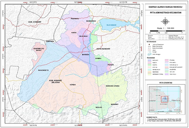
This study aimed to evaluate land suitability for spatial-based agroforestry development by explicitly identifying the key biophysical characteristics of the Wanggu Watershed, an urban–peri-urban watershed experiencing rapid land-use change due to urban expansion and agricultural activities. The assessment focused on critical terrain and hydrological attributes, including slope class, elevation percentage, and distance from rivers, which strongly influence land productivity, erosion risk, and agroforestry feasibility.
A Geographic Information System (GIS)-based spatial analysis was applied using a Multi-Criteria Evaluation (MCE) approach. Spatial datasets derived from Digital Elevation Models (DEM), river networks, and land characteristics were classified into weighted parameters: slope (0–15%, 15–35%, >35%) and river buffer distance (0–500 m, 500–1000 m, >1000 m). Each parameter was scored and overlaid to generate the land suitability maps. Field verification was conducted at 40 sampling points across six sub-districts to ensure consistency between spatial modeling and actual biophysical conditions.
The results revealed distinct spatial patterns of land suitability driven by topographic variations. Lowland areas with gentle slopes (0–15%) are predominantly classified as suitable for productive agroforestry systems, whereas moderately sloping areas (15–35%) require conservation-oriented agroforestry practices. Steep terrains (>35%), mainly located in upstream regions, are more appropriate for protection and for ecological rehabilitation. In terms of hydrological proximity, areas located 500–1000 m from rivers showed the highest suitability, whereas riparian zones require careful ecological management. Overall, approximately 65–70% of the watershed is categorized as “Suitable,” and 30–35% as “Moderate.”
These findings demonstrate that integrating biophysical characteristics through GIS-based MCE provides a robust basis for agroforestry zoning, thereby supporting sustainable land management and watershed conservation strategies.
Downloads
Downloads
Published
Issue
Section
License
Copyright (c) 2026 La Ode Muhammad Erif, Kahirun, La Ode Siwi, Eka Rahmatiah Tuwu, , Davik, La Gandri, Lucky Febriyanti, Vivi Fitriani

This work is licensed under a Creative Commons Attribution-ShareAlike 4.0 International License.
Authors submitting manuscripts should understand and agree that copyright of manuscripts of the article shall be assigned/transferred to Jurnal Keteknikan Pertanian. This work is licensed under a Creative Commons Attribution-ShareAlike 4.0 International License (CC BY-SA) where Authors and Readers can copy and redistribute the material in any medium or format, as well as remix, transform, and build upon the material for any purpose, but they must give appropriate credit (cite to the article or content), provide a link to the license, and indicate if changes were made. If you remix, transform, or build upon the material, you must distribute your contributions under the same license as the original.
Jurnal Keteknikan Pertanian is an open access journal.