
Vegetation Index and Mangrove Forest Utilization through Ecotourism Development in Dodola and Guraping of North Maluku Province

Article Sidebar
-
Ecotourism, Mangrove, NDVI, Remote Sensing
Abstract
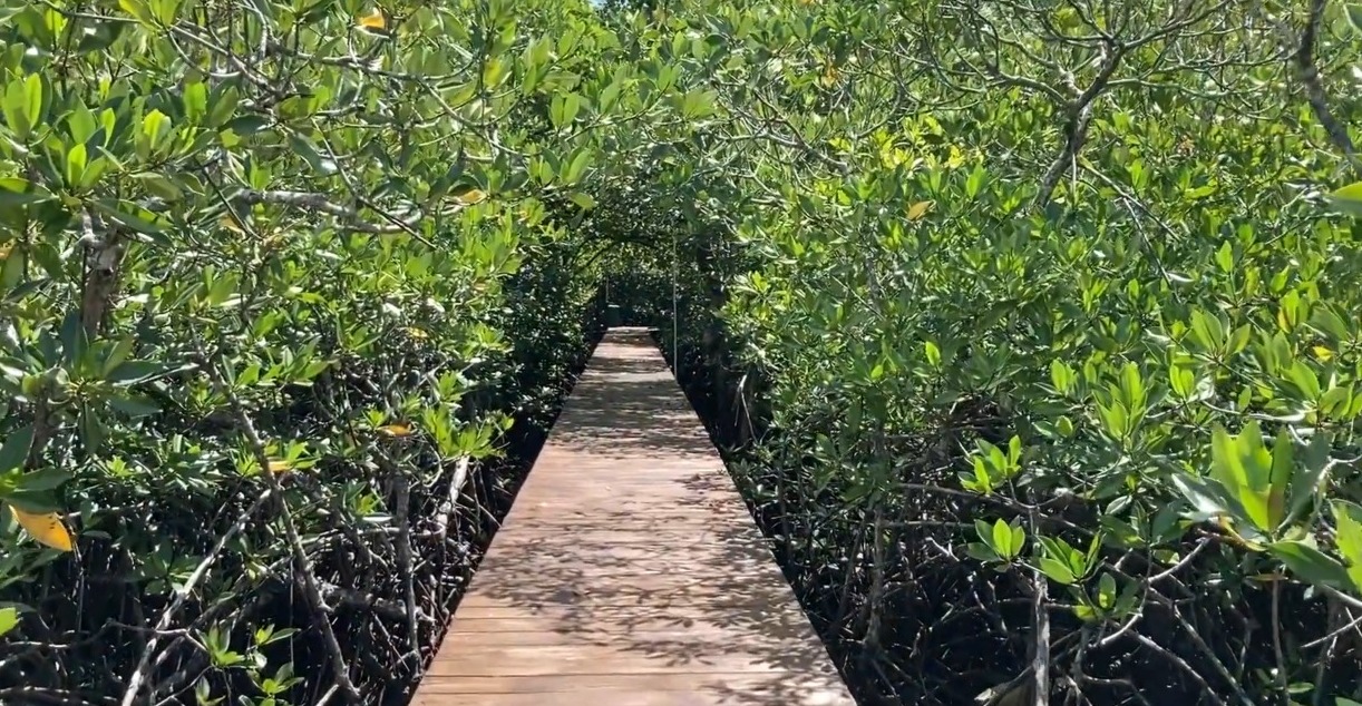
This study analyzes the vegetation index and mangrove forest utilization through ecotourism development in Guraping and Dodola Island of North Maluku Province. This research uses a remote sensing approach through Landsat 8 Operational Land Immaginer (OLI) from 2013 and 2021, calculated based on the Normalized Difference Vegetation (NDVI) algorithms. This study indicates that ecotourism development can preserve the mangrove forest and generate the economic and social benefit of the local community. Otherwise, the vegetation index in mangrove areas from 2013-2021 needs to be considered seriously as the primary data to optimize the management of tourism destinations. Through the case of Dodola Island, the increased number of vegetation in 2017 experienced significant changes and threatened the sustainability of mangrove ecotourism. Thus, the mangrove monitoring needs to be optimized to anticipate the unsustainability of mangroves, which determines the sustainability of tourism in North Maluku Province. This study offers an idea to involve the local community in conserving the mangrove area through a controlled and sustainable rehabilitation program instead of economic activity purposes. The findings indicate that the existing condition of the Guraping mangrove forest in 2021 is classified as moderate compared with mangrove ecotourism in Dodola Island with sparse criteria based on the Decree of the Minister of State for the Environment in 2004, This research suggests adopting the community-based ecotourism mangrove development through collaborative advantages of all tourism stakeholders.
References
Adhiyaksa, M., & Sukmawati, A. M. (2021). Dampak wisata bahari bagi kondisi ekonomi masyarakat Desa Kolorai, Kecamatan Morotai Selatan, Kabupaten Pulau Morotai. UNIPLAN: Journal of Urban and Regional Planning, 2(2), 7. https://doi.org/10.26418/uniplan.v2i2.46501
Angkotasan, A. M., & Daud, A. H. (2016). Kajian bioekologi lamun di perairan Sofifi Kota Tidore Kepulauan, Provinsi Maluku Utara. Jurnal Techno, 5(1), 22–30. https://doi.org/10.33387/tk.v5i1.784
Idrus, S., & Kusman, M. R. (2021). Environmental quality and carrying capacity analysis of the mangrove ecotourism at Dodola Island, Morotai Island District. Jurnal Pengelolaan Sumberdaya Alam dan Lingkungan, 11(1), 120–129. https://doi.org/10.29244/jpsl.11.1
Kawamuna, A., Suprayogi, A., & Wijaya, A. P. (2017). Analisis kesehatan hutan mangrove berdasarkan metode klasifikasi NDVI pada citra Sentinel-2 (Studi Kasus: Teluk Pangpang Kabupaten Banyuwangi). Jurnal Geodesi Undip, 6(1), 277–284. Retrieved from https://ejournal3.undip.ac.id/index.php/geodesi/article/view/15439
Koroy, K., Nurafni, N., & Mustafa, M. (2018). Analisis kesesuaian dan daya dukung ekosistem terumbu karang sebagai ekowisata bahari di Pulau Dodola Kabupaten Pulau Morotai. Jurnal Enggano, 3(1), 52–64. https://doi.org/10.31186/jenggano.3.1.52-64
Mahmud, M. A. (2018). Gerakan hijau di arus poros maritim (Rehabilitasi mangrove Maluku Utara sebagai pilar ekonomi biru). Prosiding Seminar Nasional KSP2K II, 1(2), 112–121. http://ejournal.unkhair.ac.id/index.php/ksppk/issue/view/90
Nurafni, & Nur, R. M. (2017). Struktur komunitas lamun di perairan Pulau Dodola Kabupaten Morotai. Prosiding Seminar Nasional KSP2K II, 1(2), 138–145. http://ejournal.unkhair.ac.id/index.php/ksppk/issue/view/90
Nurdiansah, D., & Dharmawan, I. W. E. (2018). Komunitas mangrove di wilayah pesisir Pulau Tidore dan sekitarnya. Oseanologi dan Limnologi di Indonesia, 3(1), 1–9. https://doi.org/10.14203/oldi.2018.v3i1.63
Purwanto, A., & Eviliyanto. (2022). Mangrove health analysis using Sentinel-2a image with NDVI classification method (Case study: Sungai Batang - Kuala Secapah Mempawah Timur). GeoEco, 8(1), 87–97. https://doi.org/10.20961/ge.v7i3.51948
Singgalen, Y. A. (2020). Mangrove forest utilization for sustainable livelihood through community-based ecotourism in Kao Village of North Halmahera District. Jurnal Manajemen Hutan Tropika, 26(2), 155–168. https://doi.org/10.7226/jtfm.26.2.155
Singgalen, Y. A. (2022a). Priority analysis of mangrove Guraping ecotourism development based on spatial data using process hierarchy analysis. Journal of Information Systems and Informatics, 4(1), 1–15.
Singgalen, Y. A. (2022b). Tourism infrastructure development and transformation of vegetation index in Dodola Island of Morotai Island Regency. Journal of Information Systems and Informatics, 4(1), 130–144.
Singgalen, Y. A., Gudiato, C., Prasetyo, S. Y. J., & Fibriani, C. (2021). Mangrove monitoring using normalized difference vegetation index (NDVI): Case study in North Halmahera, Indonesia. Jurnal Ilmu dan Teknologi Kelautan Tropis, 13(2), 219–239. https://doi.org/10.29244/jitkt.v13i2.34771
Singgalen, Y. A., Sasongko, G., & Wiloso, P. G. (2019). Ritual capital for rural livelihood and sustainable tourism development in Indonesia. Jurnal Manajemen Hutan Tropika, 25(2), 115–125. https://doi.org/10.7226/jtfm.25.2.115
Wijaya, N. I., & Huda, M. (2018). Monitoring sebaran vegetasi mangrove yang direhabilitasi di kawasan ekowisata Mangrov Monorejo Surabaya. Jurnal Ilmu dan Teknologi Kelautan Tropis, 10(3), 2087–9423. https://doi.org/10.29244/jitkt.v10i3.21271
Authors

This work is licensed under a Creative Commons Attribution 4.0 International License.
Jurnal Manajemen Hutan Tropika is an open access journal which means that all contents is freely available without charge to the user or his/her institution. Users are allowed to read, download, copy, distribute, print, search, or link to the full texts of the articles in this journal without asking prior permission from the publisher or the author. This is in accordance with the Budapest Open Access Initiative (BOAI) definition of open access.Article Details


