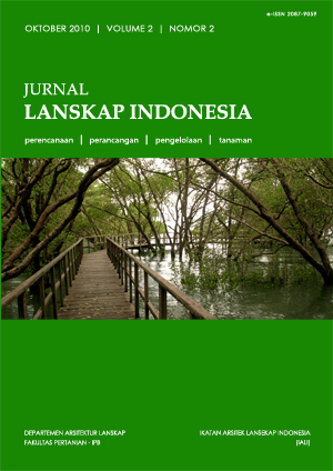
PERENCANAAN HUTAN KOTA REKREASI MANGROVE DI WILAYAH PESISIR KECAMATAN KUTA RAJA, KOTA BANDA ACEH, PROPINSI NAD
Abstract
The study was located in Kuta Raja Sub-District, Banda Aceh City, Nanggroe Aceh Darussalam Province. The site is coastal areawhich was directly affected by eartquake and tsunami disaster that caused environmental degradation and significantly reduced the area of land.
The area of site planning is 316.65 Ha, covers 78.76 Ha of Gampong Jawa Village, 211.24 Ha of Gampong Pande Village, and 26.65 Ha of Peulanggahan Village. The site has unique character of coastal area with clay soil and flat topography,and consisted of land and inundated areas. Ecological concept has
been applied to the forest, with aim to improve environmental quality of the city after tsunami. Besides, the urban forest is hopefully indirectly able to protect the land area behind, and also as recreational areafor urban communities.
Downloads
This journal permits and encourages authors to post items submitted to the journal on personal websites or institutional repositories both prior to and after publication, while providing bibliographic details that credit, if applicable, its publication in this journal. However, after the article is submitted and published in this journal, it is fully copyrighted by the Jurnal Lanskap Indonesia or JLI. If excerpts from other copyrighted works are included, the author must obtain written permission from the copyright owner and give credit to the source in the article. Then, the writer or reader is allowed to copy, share, and redistribute articles/material in any form. But it must still include the appropriate source and credit because the article in this journal is licensed by Creative Commons Attribution 4.0 International License (CC BY 4.0).
I. Proposed Policy for Journals That Offer Open Access
Authors who publish with this journal agree to the following terms:
- Authors retain copyright and grant the journal right of first publication with the work simultaneously licensed under a Creative Commons Attribution License that allows others to share the work with an acknowledgement of the work's authorship and initial publication in this journal.
- Authors are able to enter into separate, additional contractual arrangements for the non-exclusive distribution of the journal's published version of the work (e.g., post it to an institutional repository or publish it in a book), with an acknowledgement of its initial publication in this journal.
- Authors are permitted and encouraged to post their work online (e.g., in institutional repositories or on their website) prior to and during the submission process, as it can lead to productive exchanges, as well as earlier and greater citation of published work (See The Effect of Open Access).
II. Proposed Policy for Journals That Offer Delayed Open Access
Authors who publish with this journal agree to the following terms:
- Authors retain copyright and grant the journal right of first publication, with the work after publication simultaneously licensed under a Creative Commons Attribution License that allows others to share the work with an acknowledgement of the work's authorship and initial publication in this journal.
- Authors are able to enter into separate, additional contractual arrangements for the non-exclusive distribution of the journal's published version of the work (e.g., post it to an institutional repository or publish it in a book), with an acknowledgement of its initial publication in this journal.
- Authors are permitted and encouraged to post their work online (e.g., in institutional repositories or on their website) prior to and during the submission process, as it can lead to productive exchanges, as well as earlier and greater citation of published work (See The Effect of Open Access).


